

Houston weather: Strong, severe thunderstorms possible Thursday
HOUSTON - The hot and dry August-like pattern is changing for Houston as we move into the end of the workweek.
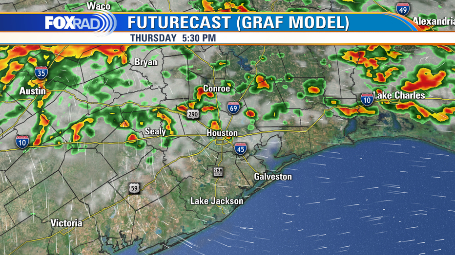
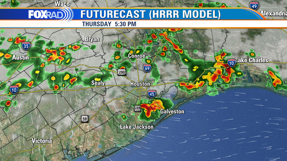
Thursday will still be warm, but showers and thunderstorms are expected to develop across Southeast Texas during the afternoon and evening.
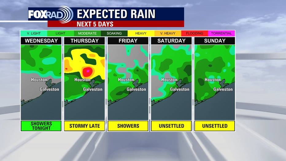
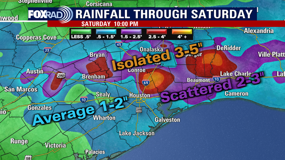
A weak front will crawl into the region bringing showers and storms with it. Some of those storms may cause localized short-term flooding from heavy rainfall.
DOWNLOAD THE FOX 26 WEATHER APP FOR FORECAST UPDATES
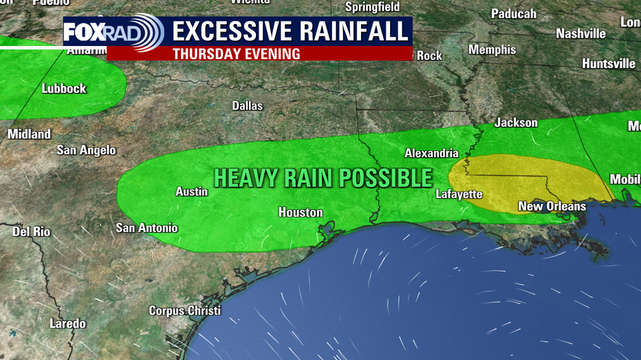
The Weather Prediction Center currently has most of the FOX 26 area under a marginal risk of excessive rainfall. There will also be a few storms producing strong to severe winds.
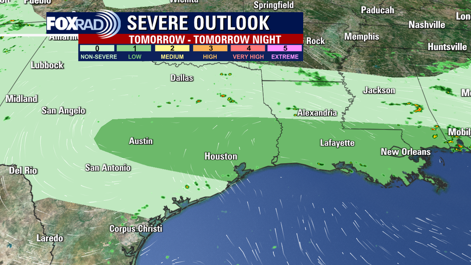
The Storm Prediction Center has issued a marginal threat for severe weather with the main concern being those possible damaging winds.
It looks like the timing of these storms could hit during the rush hour in and around the Houston metro area, so remember to never drive through water!
If you have late afternoon outdoor plans, stay weather aware with the FOX 26 Weather App.
Overall, the weather pattern remains unsettled with rain chances in the forecast and temperatures below the late August norms.
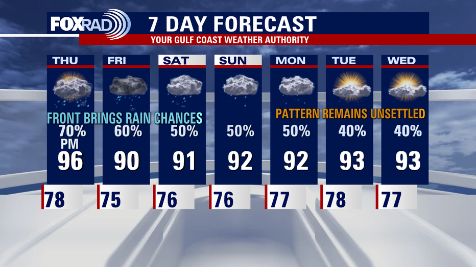
We are also watching a tropical wave near Central America, which is headed for the Gulf of Mexico. Go to our FOX 26 YouTube Channel for the latest tropical weather forecast discussion video.