

Hurricane Beryl tracker: Category 5 storm moves west; latest projected path

Hurricane Beryl reaches DEVASTATING Category 5 status
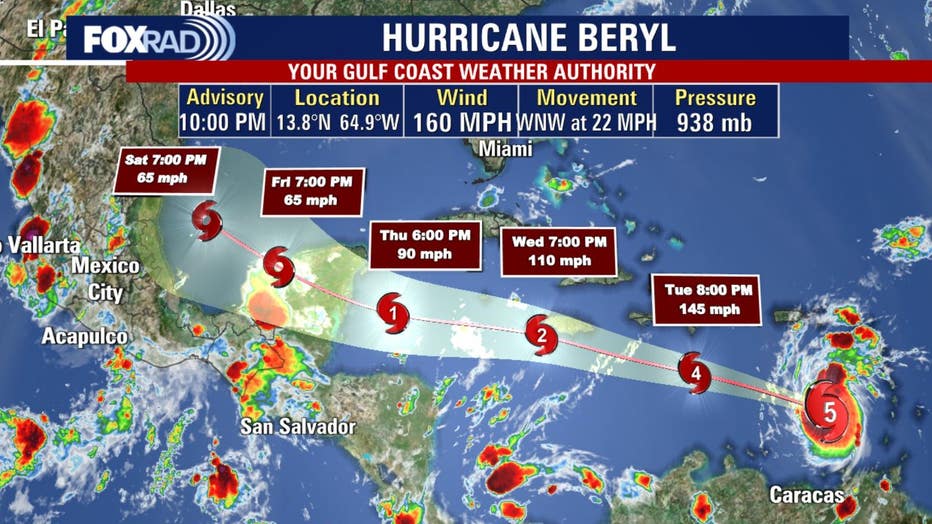
The National Hurricane Center has announced that Hurricane Beryl has reached Category 5 status, as of the 10 p.m. update on Monday night.
Click here for new updates on this story.
HOUSTON - Record-breaking Hurricane Beryl is moving westward across the Atlantic on Monday as a dangerous major hurricane.
Hurricane Beryl was a Category 4 hurricane as it hit the Windward Islands Monday morning with peak winds at 140 mph.
By Monday night at the 10 p.m. update, maximum sustained winds had increased to 160 mph in the southeastern Caribbean, making the hurricane a category 5 hurricane.
SUGGESTED: Are you prepared for hurricane season?
According to the current forecast track, it is expected to move across the Caribbean through the middle of the week and then near the Yucatán Peninsula at the end of the week before entering the Gulf of Mexico.
Beryl has now became the earliest Category 4 Atlantic hurricane on record, beating Hurricane Dennis’s previous record set on July 8, 2005.
Despite expectations of weakening in the central Caribbean around midweek, Beryl is still forecast to retain its hurricane status.
Texas should be watching Beryl as it moves through the Caribbean. Most likely it will follow the same path as Tropical Storm Alberto, staying to the south, but there are some slight possibilities of it wandering a bit further north.
Tropical Storm Chris makes landfall
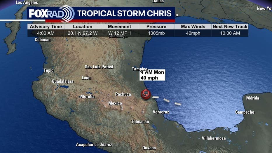
Tropical Storm Chris formed in the Gulf of Mexico late Sunday night, shortly before making landfall in Mexico. It was expected to bring heavy rain and flooding.
It weakened to a tropical depression with maximum sustained winds of 35 mph before 7 a.m. CDT.
Watching another tropical wave
A tropical wave in the Atlantic is on the heels of Hurricane Beryl. The latest spaghetti plots have this area of low pressure moving west toward the Windward Islands. There is a medium chance for further development by the middle of the week.