2025 hurricane season: Colorado State predicts 17 named storms, 4 major hurricanes, more
Colorado State University hurricane researchers predict an above-average Atlantic hurricane season in their initial 2025 forecast, reporting activity could be about 125% of the average season from 1991–2020.
Beryl, Helene, Milton removed from Atlantic hurricane list after historic impact
About 100 names of tropical storms and hurricanes have been retired from future use in the Atlantic Ocean, and now Beryl, Helene and Milton join them.
Streamlight ProTac HL 6 flashlight | Emergency Gear Test
Power can go out at any time of the year. A battery-powered flashlight or lantern is a must have. FOX 26 Meteorologist John Dawson shows us a powerful light that is rechargeable and waterproof.
National Hurricane Center tracks disturbance in the Atlantic. Here's what we know
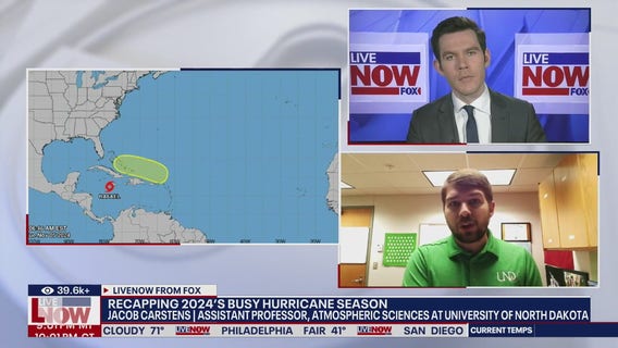
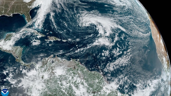
The National Hurricane Center (NHC) is monitoring a disturbance in the northern Atlantic, months before the official start of the 2025 Atlantic hurricane season.
Biolite Luci Charge 360 | Emergency Gear Test
A battery-powered lantern is a must during a power outage. Meteorologist John Dawson wants you to have 36 hours of light in your emergency kit. In this gear test, he shows us a solar-powered rechargeable lantern that can also be used as a power bank.
Survival Frog Zombinator survival hatchet
On today's emergency gear test, meteorologist John Dawson shows us a unique multi-tool that could be added to your supplies.
Survival Frog Zombinator Survival Hatchet
FOX 26 Meteorologist John Dawson takes a look at the Survival Frog Zombinator Survival Hatchet in this Emergency Gear Test.
Emergency Gear Test: Rapid Rope Utility Rope
We know a big part of emergency preparedness is planning for the unexpected. Storing some basic tools and materials will help you deal with those unexpected events. On this emergency gear test, Meteorologist John Dawson focuses on one of those supplies.
Midland Portable Emergency Weather Alert Crank Radio
A crank powered flashlight radio is probably in your emergency preparedness kit. In this Emergency Gear Test, Meteorologist John Dawson shows us a new model from a company that has been making them for years.
Emergency Gear Test: Klean Freak Body Wipes
It can sometimes be difficult to maintain proper hygiene during an emergency due to a loss of power or limited water. So on today's emergency gear test, meteorologist John Dawson has a way to help us stay fresh.
Klean Freak Body Wipes: Emergency Gear Test
During an emergency, it could become hard to keep up with your hygiene and Meteorologist John Dawson has a way you can stay fresh with body wipes.
Hurricane Beryl FEMA aid: Some still waiting on reimbursements six-months later
Some FEMA applicants in Houston-are still waiting six months after Hurricane Beryl to be reimbursed for their generator purchases.
FEMA generator aid delayed for Hurricane Beryl
Did you have to buy to rent a generator after Hurricane Beryl? FEMA announced they would reimburse residents for those costs, but FOX 26 Consumer Reporter Heather Sullivan spoke with those who are still waiting six months later.
Rumpl Original Puffy Blanket: Emergency Gear Test
Are you prepared for an arctic blast? Meteorologist John Dawson focuses on what you need to keep in your vehicle for a cold weather emergency.
Outask Telescopic Lantern: Emergency Gear Test
Have you considered a rechargeable lantern as your battery-powered light in your emergency kit? In this Emergency Gear Test, Meteorologist John Dawson shows us one that can run for more than 60 hours.
Life+Gear First Aid & Survival Pack: Emergency Gear Test
In this Emergency Gear Test, Meteorologist John Dawson focuses on first aid kits and what should be in them.
Rocky Talkie 5 Watt Radio: Emergency Gear Test
When it comes to natural disasters, there is no guarantee all the cell phone towers will stay up and running. Meteorologist John Dawson has a device that might help in any emergency setting. Hurricane season is over, but we should stay ready for the unexpected. Meteorologist John Dawson is still reviewing products that could be helpful in stressful times. On today’s Emergency Gear Test, he talks about having a good way to store those supplies needed for disasters.
Peak Design Travel Duffelpack 65L: Emergency Gear Test
Hurricane season is over, but we should stay ready for the unexpected. Meteorologist John Dawson is still reviewing products that could be helpful in stressful times. On today’s Emergency Gear Test, he talks about having a good way to store those supplies needed for disasters.
Gear Test overview: Necessities for hurricane kit
Hurricane season is officially over for 2024. Meteorologist John Dawson wraps up the season with a review of all the basic requirements you need for a hurricane preparedness kit!
Anker Solix F3800 Power Station: Hurricane Gear Test
Hurricane season is coming to it's end, but FOX 26 Meteorologist John Dawson has one last Hurricane Gear Test to showcase the Anker Solix F3800 Power Station.


