

More on Hurricane Francine's landfall in Louisiana
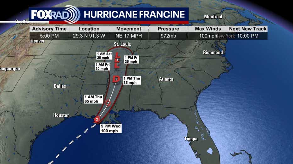
HOUSTON - Hurricane Francine made landfall in southern Louisiana about 30 miles SW of Morgan City in Terrebone Parish shortly before 5 pm. At time of landfall, winds were around 100 mph.
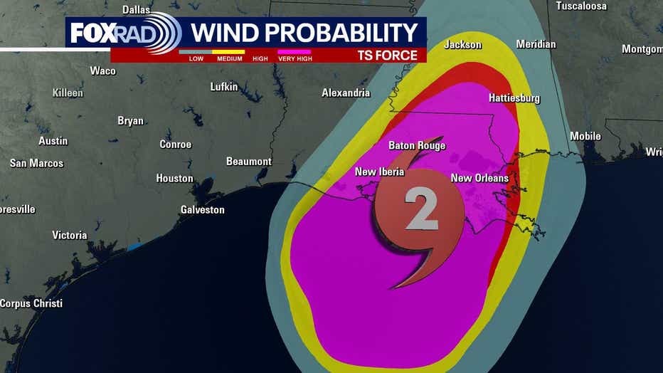
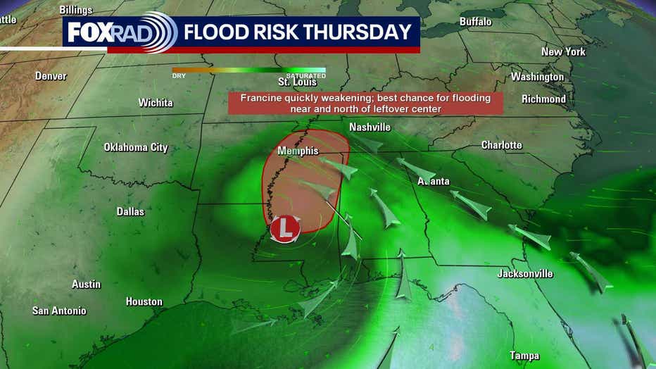
Francine will bring a significant flood threat to Louisiana, Mississippi & Alabama over the next day or two as it moves inland. Up to a foot of rain could fall in parts of Louisiana.
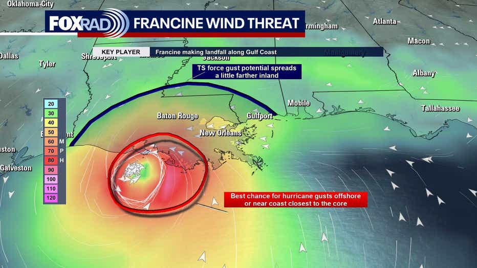
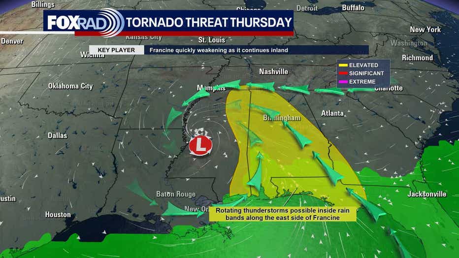
Tornadoes, hurricane force winds and storm surge will all be threats as Francine moves inland.
Baton Rouge and Morgan City are both going to feel hurricane force winds on Wednesday evening and Wednesday night.
Francine will gradually weaken to a tropical depression by Thursday afternoon as it gets close to Memphis.
A Coastal Flood Advisory continues for coastal regions of SE Texas with storm surge up to two feet possible. That means you should watch out for potential flooding along the SE Texas coastline.
Additional rain for SE Texas will likely be less than an inch through Wednesday night.
Francine will move away making way for the return of sunshine and warmer temperatures to wrap up the week.