Houston weather: Widespread rain to roll into Houston area early Thursday morning
HOUSTON - Fall is usually a time of transition and things are definitely changing this week for Houston!
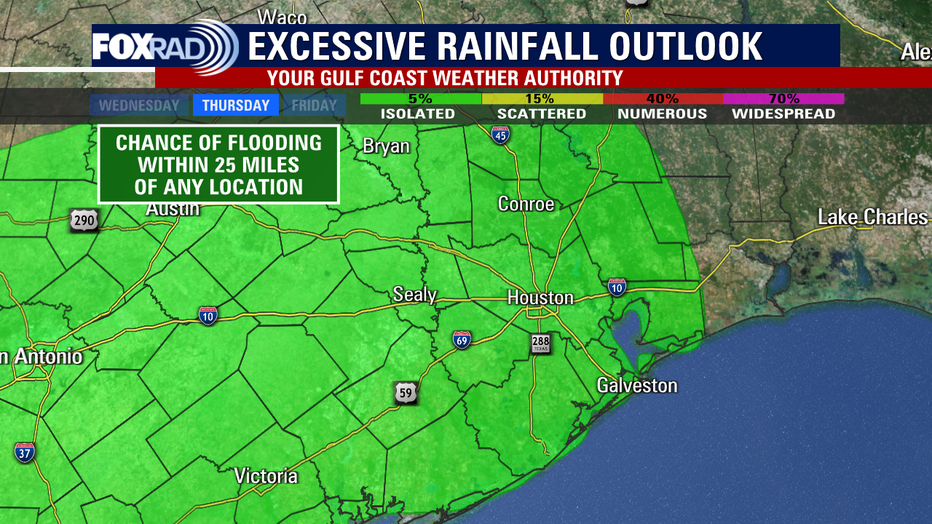
Thursday is expected to be another busy weather day across southeast Texas as our first fall cold front comes rolling in from the NW. We have already had several rounds of rain this week that has led to some drought relief but also some areas of flooding. In fact, parts of south central Brazoria County have picked up nearly 10 inches of rain over the last two days!
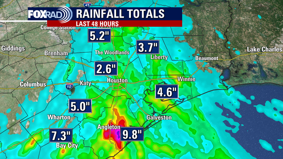
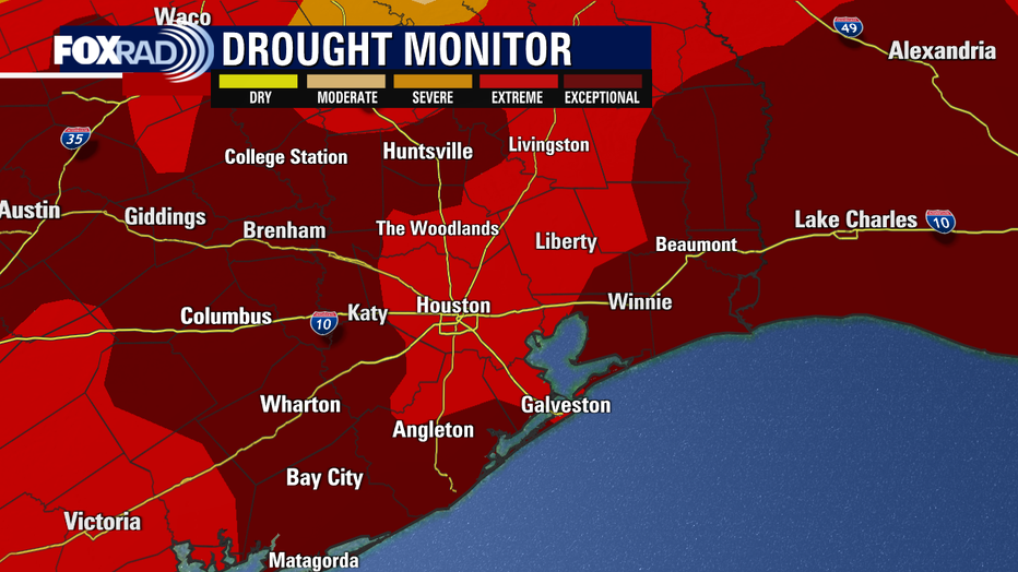
Widespread flooding was reported in Freeport early Wednesday afternoon and areas near Bay City in Matagorda County have picked up around 7-8 inches of rain over the last few days. Houston has racked up around 2-3 inches of rain since Tuesday which will certainly help with the drought conditions. Houston and surrounding areas remain in extreme to exceptional drought with an updated drought monitor set to arrive Thursday morning. There will likely be improvements with all of the recent rain.
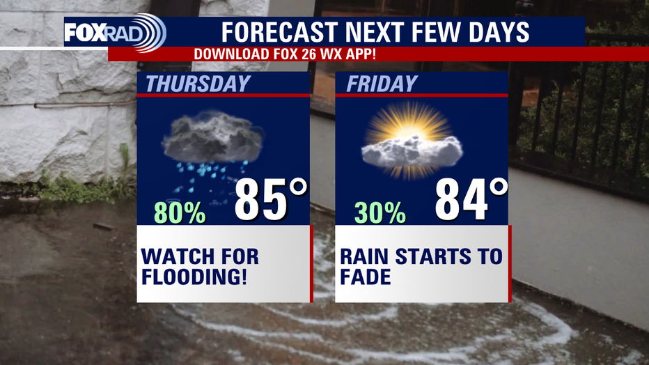
Here's the expected timing for Thursday's big rain event. Look for widespread rain to roll into Houston likely around 6-8 a.m. Thursday and stick around through the early - mid afternoon.
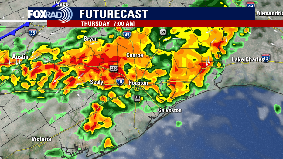
Best chance for rain is likely from 7 a.m. until 3 p.m. Thursday.
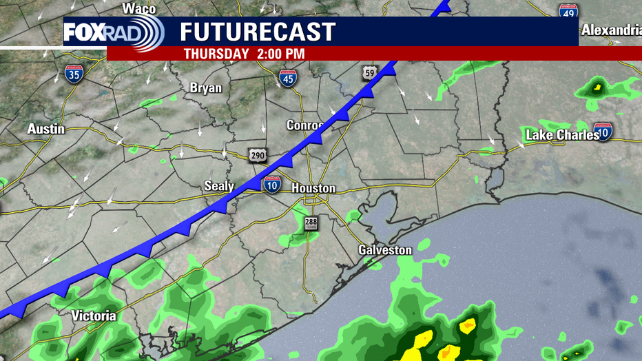
Rain should gradually fade by evening. An additional 1-2 inches of rain is possible with isolated higher amounts.
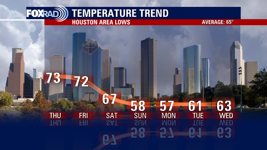
A few showers may linger Friday, but cooler and drier air arrives just in time for your weekend plans! You may even pull out the long sleeves or light jacket this weekend with temperatures in the 50s likely Sunday and Monday morning! Make your weekend outdoor plans so that you can enjoy this first real taste of fall! But stay alert Thursday morning and afternoon for heavy rain that could cause some flooding issues!