Houston weather: Why didn't we get as much severe weather than what was forecasted?
What is the 'Cap?'
FOX 26 Meteorologist Remeisha Shade explains why the anticipated severe weather on Thursday in Houston wasn't as bad as expected.
HOUSTON - The threat for severe weather isn't completely over today, but so far, conditions have not been quite as bad as anticipated.
Models were indicating high amounts of shear or spin in the atmosphere. Winds in our atmosphere today were very strong and changing direction with height. Usually this signals a risk for tornadoes if there is enough instability.
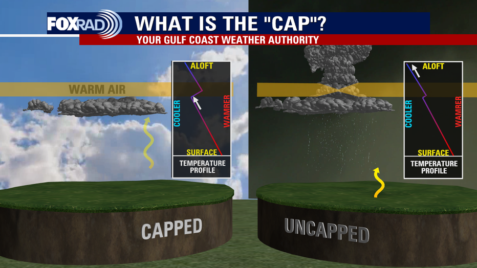
But the rounds of heavy rain have helped to limit heating, allowing the atmosphere to become more unstable. The atmosphere is what we called "capped" today. What does that mean?

Well it means that there's a layer of warm air above us in the atmosphere that limits or hinders thunderstorms from building vertically and blowing up into dangerous supercells that could produce tornadoes or damaging winds.
If a storm were to break through that "cap" or "lid", it could have quickly become severe. But so far, none of these storms today were able to do that.
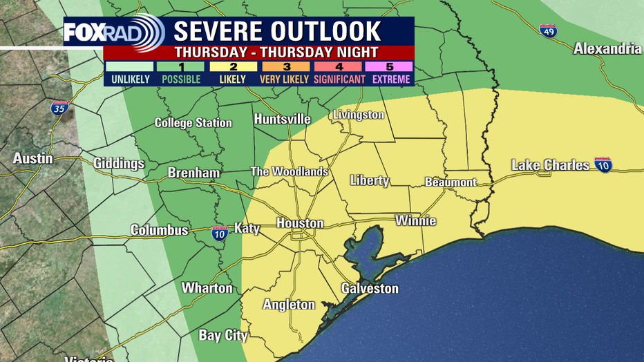
The rounds of rain and low clouds have helped to lower and limit the severe threat. There's still a low chance of a strong to severe storm through early evening. So don't let your guard down. Houston is still in a category 2 out of 5 risk for severe storms the rest of today.

But the category 3 out of 5 higher enhanced risk for severe storms is no longer in our area.

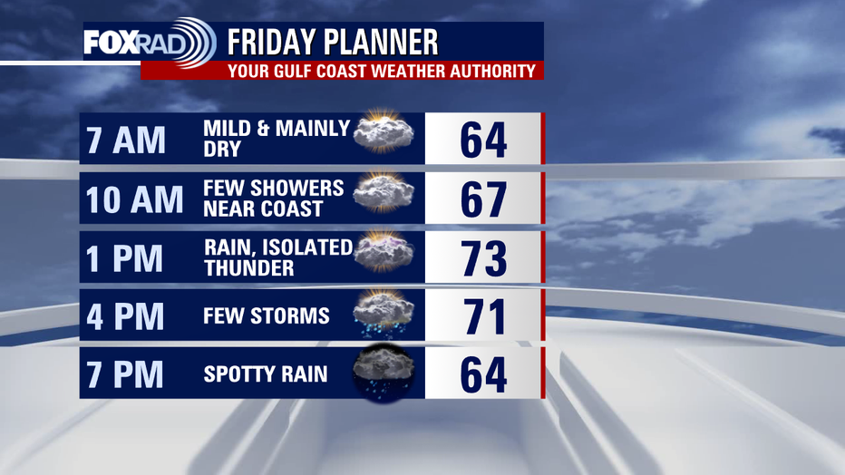
Threat for flooding will remain elevated with downpours early this evening and another round of rain & a few storms expected Friday afternoon near a stalled front. At this time, severe weather is not expected Friday.


