

Houston weather: Wind Advisory returning Thursday; potential storm in northern SE Texas
Houston weather: Wind Advisory returns Thursday; possible storms up north
The National Weather Service has issued a rare high risk for severe storms and tornadoes for parts of Arkansas, Tennessee, Missouri and Kentucky. For SE Texas, there is a slight chance for strong storms closer to Huntsville, College Station and Livingston over the next few days.
HOUSTON - Stay up-to-date on the latest weather where you live by downloading the FREE FOX Local app on your phone and smart TV.
Windy and muggy pattern
Thursday and Friday will bring winds from the south between 15–25 miles per hour with gusts near 30-40 mph, so hold on to your hat.
A WIND ADVISORY will once again be in place from 7am to 5pm on Thursday.

Also, be careful on the highways because high-profile vehicles like 18-wheelers could be pushed by brief wind gusts, so give them plenty of room. Otherwise, you'll notice summer-like humidity and temperatures that will be close to record highs in the upper 80s.
Severe weather outbreak for several states
The National Weather Service has issued a rare high risk for severe storms and tornadoes for parts of Arkansas, Tennessee, Missouri and Kentucky.
Many other areas from North Texas to Indiana could see large hail, high winds and isolated tornadoes through Thursday night.
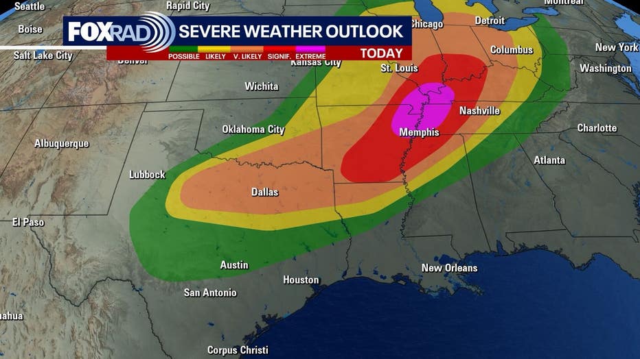
For our area, there is a slight chance for strong storms closer to Huntsville, College Station and Livingston over the next few days.


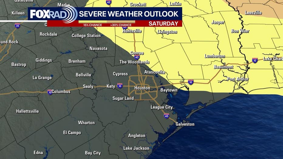
Saturday washout, then chilly

For now, plan on rain nearly everywhere in the Houston area on Saturday. The intensity is still unclear, but there will be a chance for some strong storms especially north and northeast of Houston.
A cold front will move in after the rain, and it will get legitimately chilly. There is no concern about any freezing temperatures, as they are extremely rare in April, and models are showing lows closer to the upper 40s on Sunday, Monday and Tuesday night, and that's pretty chilly for springtime.

The Source: Your Gulf Coast Weather Authority