

Houston weather: Slight winds Tuesday, temps in the 80s
Houston weather: Mild Tuesday morning, some fog
Patchy fog and mist Tuesday morning, then partly cloudy and breezy with highs in the low 80s. An area of low pressure is expected to bring several rounds of severe storms to North Texas and pull winds in off the Gulf for the Houston area.
HOUSTON - Patchy fog and mist Tuesday morning, then partly cloudy and breezy with highs in the low 80s.
More humid winds return
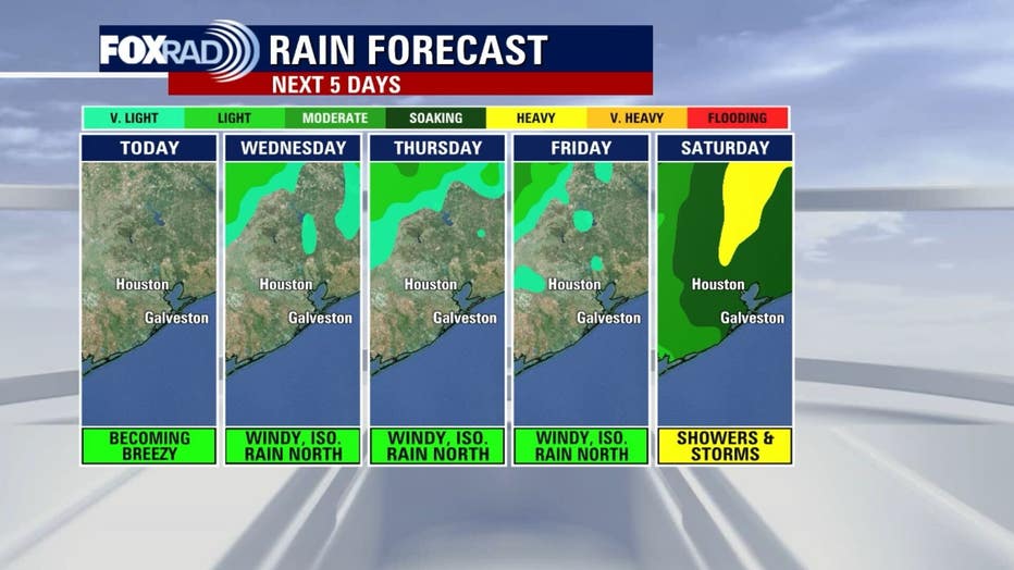
As an area of low pressure brings several rounds of severe storms to North Texas into the Midwest, it will also pull winds in off the Gulf for the Houston area. Wind speeds should increase to about 15 mph and in the 15-25 mph range through Friday.

With the winds blowing in from the south, humidity and temperatures will increase, so look for highs in the upper 80s and lows in the mid 70s.
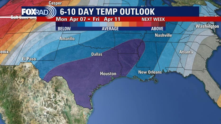
Near record highs
Record highs for today, tomorrow and Thursday are 89, 87 and 88 respectively - the records for Wednesday and Thursday look breakable or at least "tie-able".
Otherwise, the concern is the chance for storms for areas like College Station, Huntsville and Livingston (and surrounding areas) tomorrow through Friday as we catch the tail end of storms in Northeast Texas.
Plan for weekend rain
Storms are likely along a cold front on Saturday, so plan on downpours followed by a 10 to 15 degrees drop in temperatures. Next week will be cooler! Lows should drop to the 50s for a few mornings.
The Source: Yoru Gulf Coast Weather Authority