Houston weather: Timeline of heavy rainfall expected until Friday, threat for flooding
HOUSTON - More rain and thunderstorms are expected over the next two days after a cold front moved through Southeast Texas and stalled on Wednesday.
With an active jet stream set up, multiple disturbances are set to move across the Houston area Thursday and Friday resulting in more periods of heavy rain.
CLICK HERE TO DOWNLOAD THE FOX 26 WEATHER APP
It will likely be in waves, coming early Thursday morning, parts of Thursday afternoon and another round likely Thursday night into Friday morning. We will repeat this pattern for much of Friday with the heaviest rain expected to taper off late Friday night. Expect widespread rain totals of 1-2" on both Thursday and Friday.
With clouds and rain around, temperatures are much cooler during this time with afternoon highs only in the 60s. There's a low Category 1/5 threat for an isolated strong/severe storm Thursday but no severe storm threat Friday.


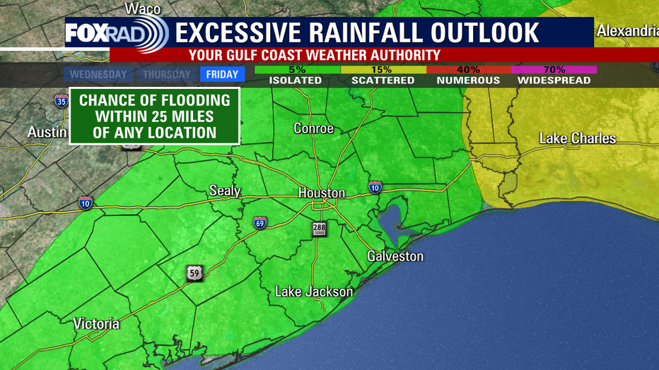
The threat of excessive rain remains elevated on both days at a 15% chance within 25 miles of a location.
Flood Threat will likely be highest late Thursday and much of Friday.
Make sure to stay weather aware and closely monitor the forecast for possible flood watches, warnings, and advisories. It's also a great time to download our FOX 26 Weather app and turn the alerts on so that you'll be up-to-date on all the weather changes.

SEVERE WEATHER: Houston Weather: Heavy rain, possible flooding and a cold front ahead of Good Friday
HOUSTON WEATHER TIMELINE
Thursday
The threat for severe weather and flooding has shifted to the west, northwest and north of Houston through the first half of the day Thursday.
Some areas have already received nearly 6 inches of rain over the last 24 hours and nearly 4 inches of rain in a three-hour time frame early Thursday morning. This has created conditions favorable for street flooding around places like Hempstead, Brenham, Navasota and Montgomery.
As far as the forecast for Houston, Galveston and surrounding areas, it does look like there’s a chance for some thunderstorms to re-enter the picture by Thursday afternoon and evening, so stay alert for that, although the forecast is not very high confidence given a bit of a chaotic weather pattern.
Friday
As far as Friday is concerned, it may be another day of heavy rain for parts of our area and Houston may be included this time, so definitely stay weather alert for both Good Friday morning and heading into the afternoon.
Saturday
The good news is that by Saturday, the heavy rain should exit leaving spotty, light rain showers for the first half of the weekend. Temperatures climb to near 70 with mostly cloudy conditions sticking around.

Sunday
Mainly dry weather is expected for Easter Sunday with only a 10-20% chance for an isolated shower.


