Francine inching closer to landfall | FOX 26 Houston Weather Forecast
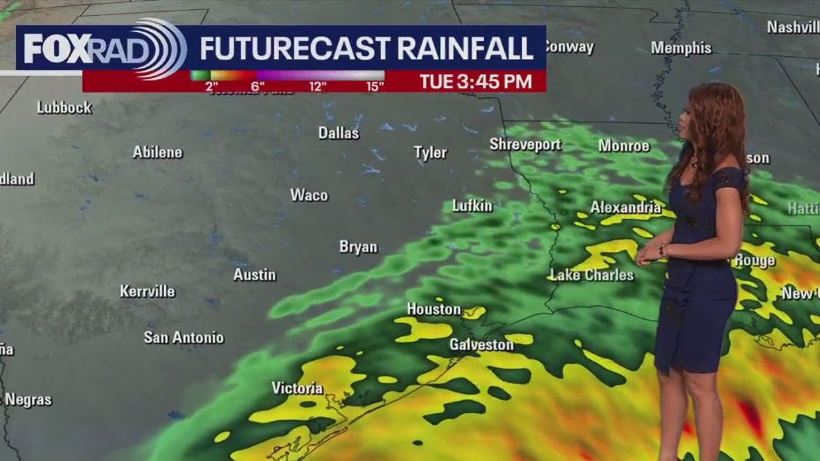
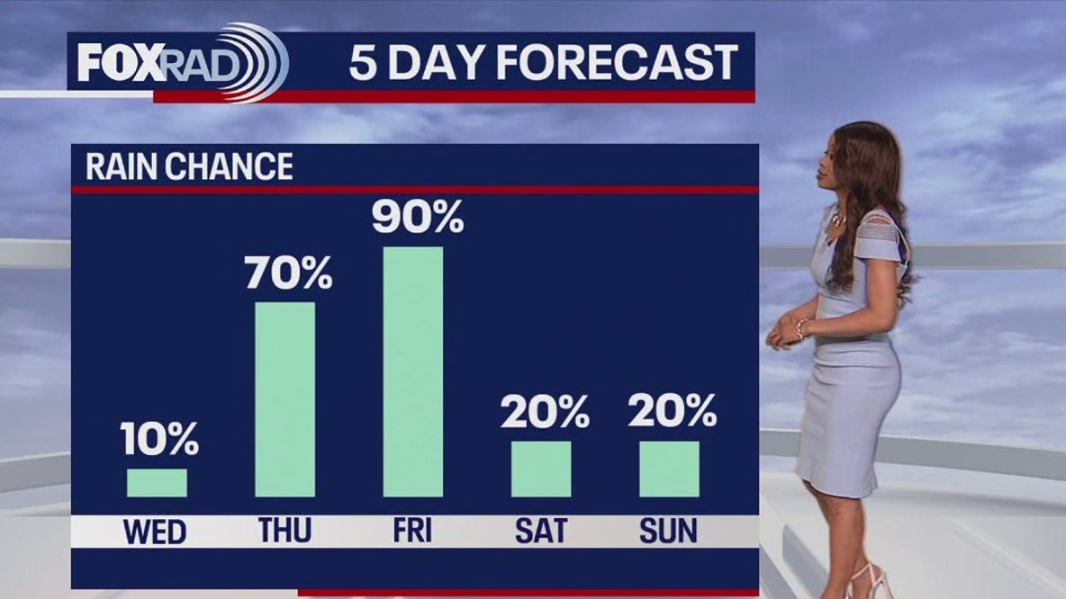
Tropical Storm Francine is quickly getting stronger in the Gulf of Mexico. It's forecast to become a hurricane overnight and is expected to make landfall as a 100 mph category 2 hurricane by early Wednesday afternoon along the Louisiana Gulf coast. The worst of Francine will head towards Louisiana but SE Texas will feel some impacts. Coastal Flood Warnings are out for Coastal areas through Wednesday afternoon with 1-3' of storm surge possible. A few flooded streets could develop farther inland over Houston Tuesday and Wednesday. Tropical Storm Watch is also in effect for Coastal areas. Main threat will be wind gusts up to 50 mph. Weather will go downhill Tuesday and Wednesday with periods of heavy rain and gusty winds. Look for a nice finish to the week with more sunshine and warm temperatures. Check out Fox Local for updates on how Francine could impact your area!
Top Videos
Francine inching closer to landfall | FOX 26 Houston Weather Forecast
Houston weather: Warm Wednesday before wet weather pattern rolls in

Houston police searching for 3 suspects connected to deadly beating