Weather in Houston: Flood watch in effect tonight for Houston and surrounding counties
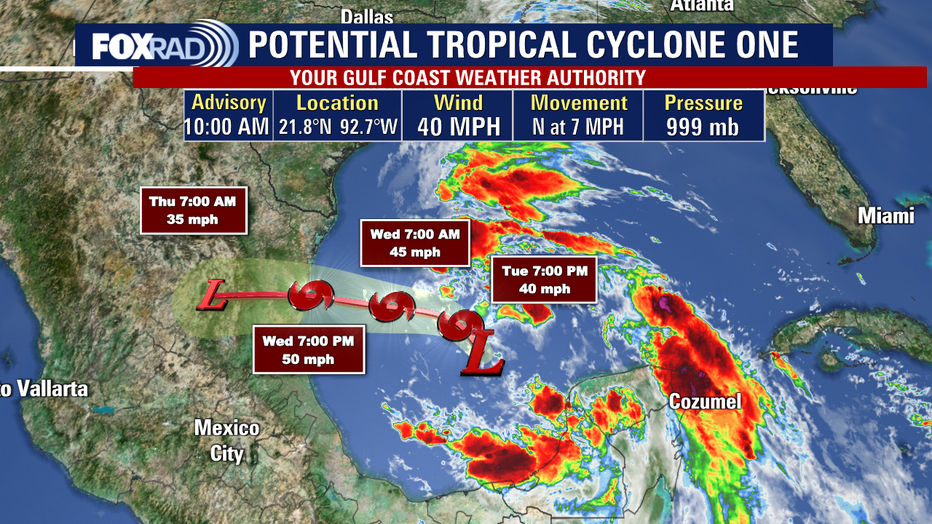
Houston - The next 24 hours are looking very busy across the Texas Gulf Coast. A developing low in the Gulf that has been dubbed "Potential Tropical Cyclone #1" may become Tropical Storm Alberto today, and it is expected to head toward the coastline of Mexico far south of our area.
The situation is not clear-cut though - there is a broad area of low pressure higher in the atmosphere that should push heavy storms toward the Houston area even though we are very far from the tropical system itself.
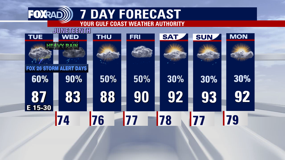
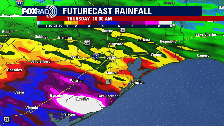
The latest models are projecting upwards of 10" of rain in Matagorda County and a solid 2-3" in the greater Houston area. Parts of Galveston, Brazoria and Fort Bend could also pick up 3-5" of rain, so flooding is a concern from late tonight through Wednesday.
There are several advisories in place: A coastal flood warning is in effect for all beached and bay areas until Thursday as tide levels could reach 2-4' above normal. A wind advisory is in effect beginning at 3pm for all areas near the coastline. Finally, a flood watch begins at 7pm tonight for Harris County and all other areas south of I-10 until early Thursday. The week should end with breezy, humid weather along with hit and miss storms.
SUGGESTED: Tropical weather development increasing, heavy rain forecasted for Texas Gulf Coast