

Substantial drought improvements continue across Texas, amidst a rainy pattern shift
Heavy rain possible over Labor Day weekend
The work week ends on a pretty typical note: partly cloudy, humid with daily afternoon scattered showers or storms. But get ready for another bumpy ride over the long holiday weekend, where rounds of heavy rain will be possible. Tropical Storm Danielle has formed in the north Atlantic Ocean and will not impact the United States in any way, but it's our first named system since Colin over July 4th weekend, 59 days ago.
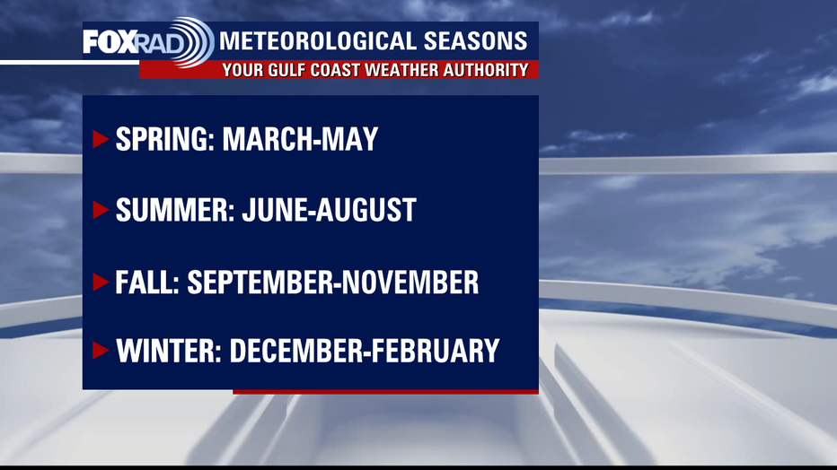
HOUSTON - September 1 marks the first day of Meteorological Fall.
For easy data-keeping purposes, the meteorological seasons are divided into three-month quarters rather than separated by astronomical factors. The start of Fall that most know is on the Autumn Equinox which this year falls on September 22; that is the start of Astronomical Fall.
Meteorological Summer was definitely interesting from a climatological perspective. We were off to the races with the heat, on track to experience the most triple-digit heat we have seen in a long time and possibly ever.
CLICK HERE FOR MORE WEATHER COVERAGE
Heat dome after heat dome set up, exacerbating the drought with seemingly no end in sight. May was the second hottest on record, then June and July were the hottest on record.
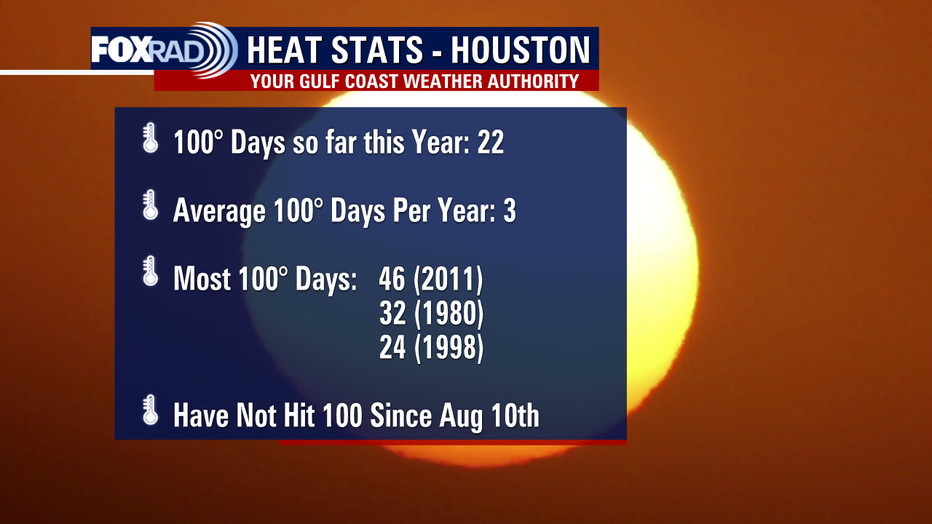
Cue August and we have now not seen a triple-digit day since August 10 at Bush - IAH, which serves as the official climate reporting site for Houston. Ironically, the last triple-digit day of the season normally occurs on or before August 10.
PREVIOUS: U.S. Drought Monitor shows nearly all of Texas in drought
That is one "normal" we did actually hit. Our average temperatures trend downward from here on out. And while we could certainly see one or two more, the odds of that dwindle drastically from here on out. The latest triple-digit day on record was September 27, 2005.
So it looks like this year will stack up as #4 for triple-digit days, with a slim chance that it ties in for #3 if we squeeze out a couple more abnormally hot days. I'm sure this is a stat that most are happy with, in addition to the continuation of mother nature's "apology tour" re: drought relief.
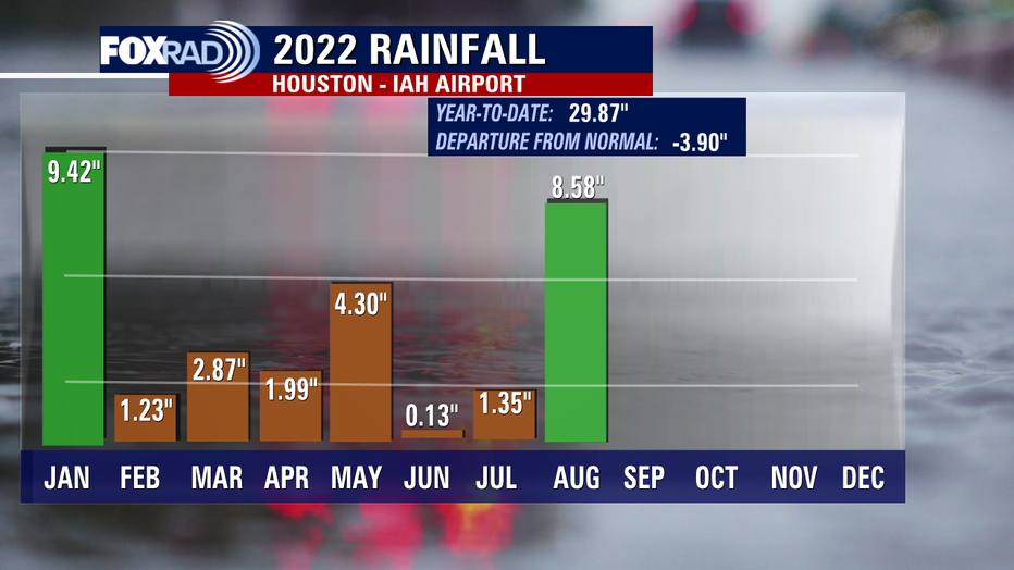
August will go down as the 10th wettest August on record from a rainfall perspective, with Bush-IAH picking up 8.58" of rain. That's more than April, May, June, and July combined.
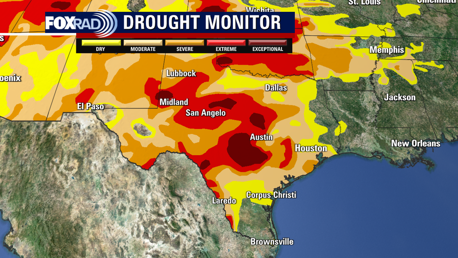
The latest drought monitor update this morning shows a very promising continued decline for what was set up to be one of the worst droughts we have experienced in a while.
After six consecutive weeks with over 90% of the state of Texas in one of the four drought categories, last week that number dropped to 87% and this week to 76%. We have not been in the 70% range since mid-June.
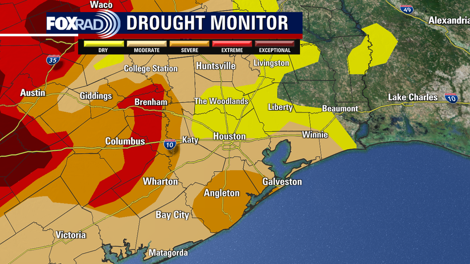
Most notably, there is only 5% of the state now in d4/exceptional - the worst of the worst drought categories. We have not seen single digits in that category since April. 26% of the state is extreme or worse for the first time since March and so on and so forth.
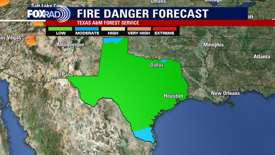
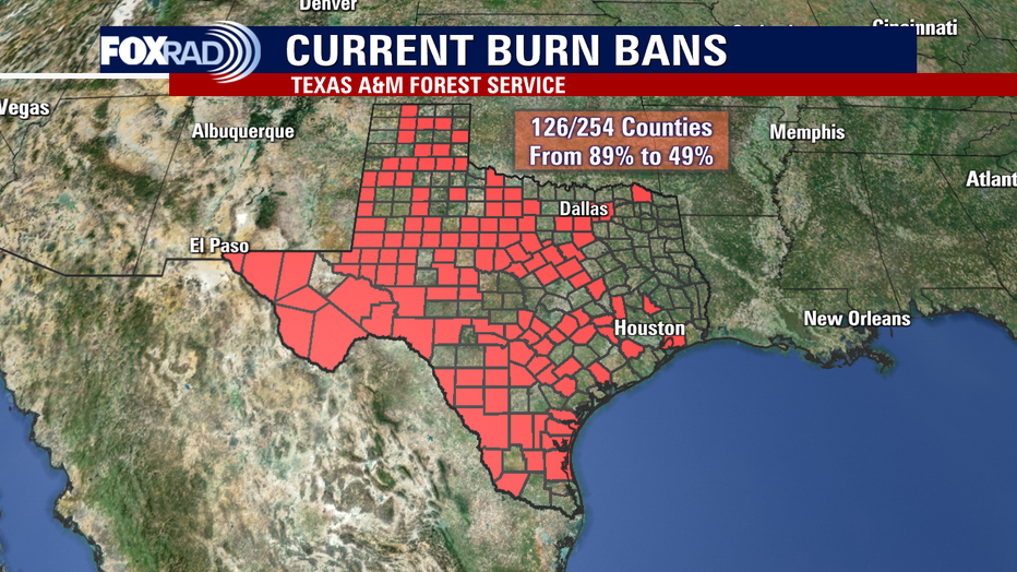
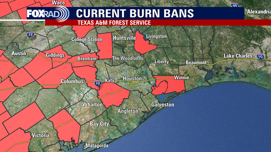
Roughly 10% of the state has exited the drought altogether, burn bans have dropped left and right, wildfire danger is lower, and there is plenty more rain on the horizon as our unsettled weather pattern continues.
Locally, the far northeast tip of liberty county is drought-free with much of the region just "abnormally dry" or only in the first drought category.
Areas to the west are still hurting, but we have another healthy dose of moisture on the way for Labor Day Weekend.
For those details, click here.