

Houston weather: Flood threat extends into the weekend
HOUSTON - Our weather whiplash continues with crazy weather that has affected Houston all week.
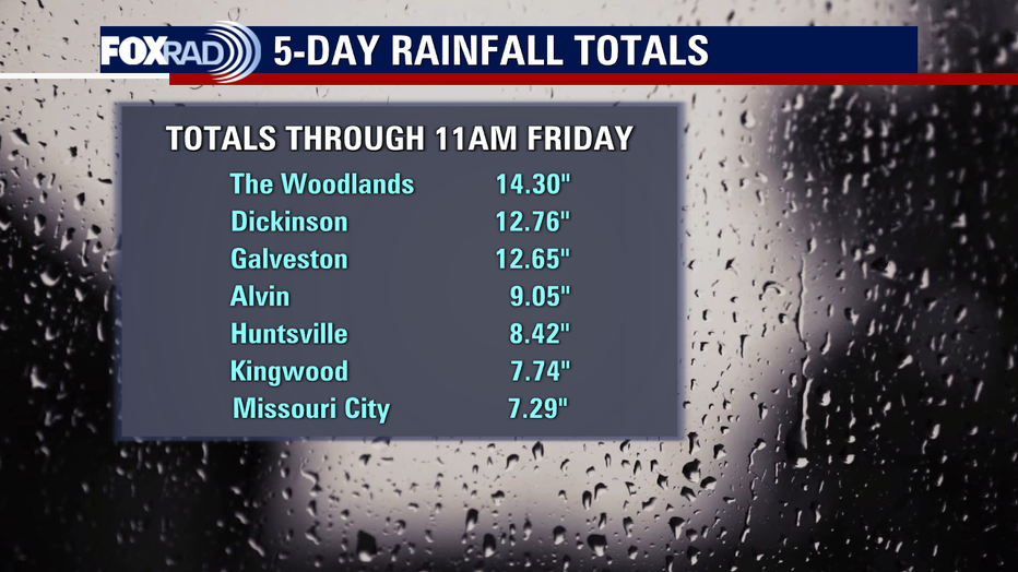
Total rain for Houston (Bush Airport) this month has been near 46 inches which is almost 18" above normal!
SUGGESTED: National Hurricane Center monitoring tropical disturbance in the Atlantic
July rain is about seven inches above normal. Galveston has already moved up the list to third wettest July on record with close to 18 inches.
It's been a super soggy week with several flooding issues and more flooding is expected this weekend.
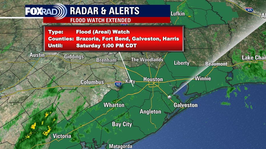
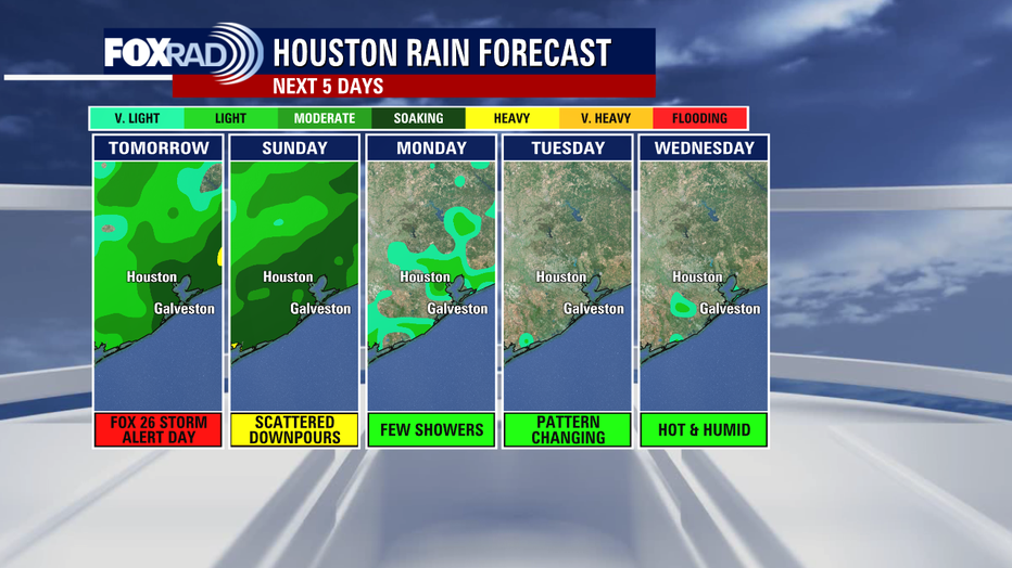
Saturday will once again be a FOX 26 Storm Alert Day.
The Flood Watch has been extended until 1 p.m. Saturday from Houston to Liberty to Galveston & down to Palacios.
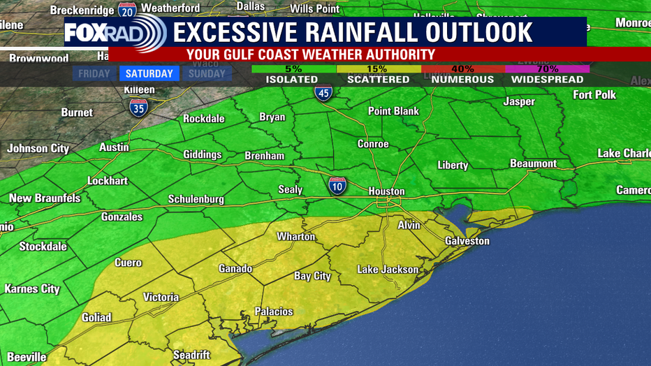
Additional one to four inches of rain is still possible through Saturday evening.
Futurecast shows another big wave of rain moving from the coast inland Saturday morning with scattered downpours through the afternoon.
Biggest flood risk will be closer to the coast Saturday in areas like Galveston, Alvin & Lake Jackson.
But Houston is still in an elevated street flooding risk also.
The good news is that a MAJOR pattern change is on the horizon next week with some hot and steamy days but less heat.
Grab our FOX 26 WX App on your phone and get updates on possible flooding Saturday on your big screen at home with our smart tv app Fox Local!