

Houston weather: Flood threat increasing for Houston next week
HOUSTON - We have gone from one weather extreme to the other in Houston over the last few weeks. We went from severe storms and tornado warnings to an arctic blast and several icy streets.
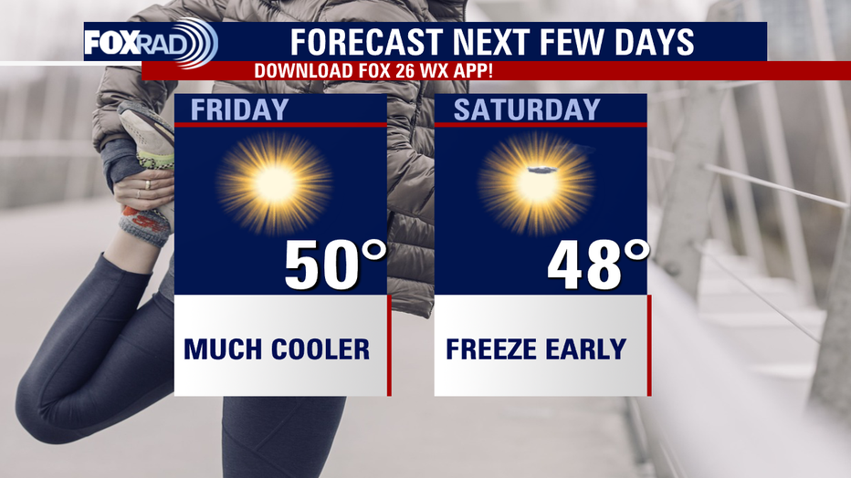
The weather should be chilly but dry for Friday and Saturday.
However, next week we are preparing for yet another big shift in the weather pattern.
The Climate Prediction Center is calling for a 50-60% chance for above normal rainfall for the Houston area next week.
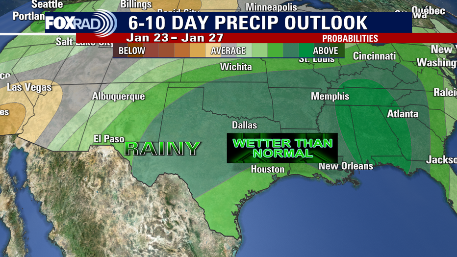
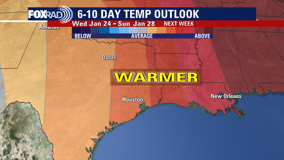
We are anticipating above normal temperatures in the 60s. So that means warmer and very wet weather next week.
A series of disturbances will roll through the area with rounds of rain coming. Showers will increase Sunday afternoon and evening with widespread heavy rain and a few storms likely Monday and Tuesday.
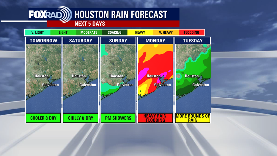
We are already in a 15% slight risk for excessive rain that could lead to street flooding for Monday.
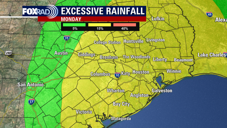
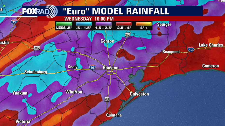
That means several streets could get flooded on Monday so remember to always avoid driving across flooded roads and find an alternate route. The European Model shows around 1-4" of rain for the Houston area from Sunday night through Wednesday night.
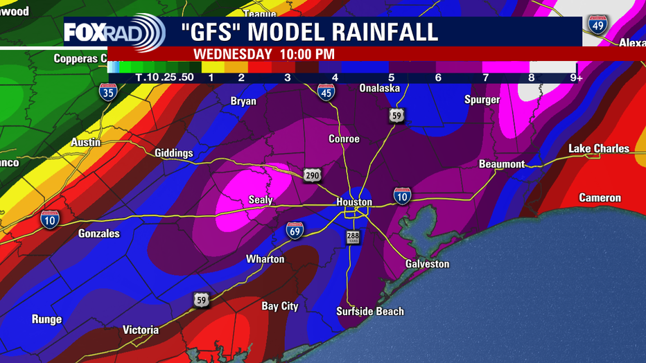
But the GFS Model is more aggressive, painting as much as 4-7" of rain piling up across Houston from Sunday through Wednesday night!
Hopefully, the models will back off on some of that rain. But for now, dust off the umbrellas, ponchos and rain boots and get ready for some super soggy weather next week!
Remember that we will be tracking every angle of this flood threat for next week with exclusive content and special coverage on our smart TV app Fox Local. So check it out by downloading it from your smart TV's app store!