

Houston weather: Flood threat continues with severe storm threat increasing
HOUSTON - What a crazy 2024 it's been so far with Mother Nature on a rampage!
A few weeks ago, we had temperatures near 80 and a confirmed tornado. Last week we had temperatures in the teens and several icy roads. This week we are warm again with several inches of rain expected over the coming days!
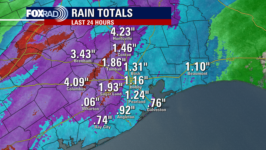
In fact, we had rain totals for much of the area Monday ranging from 1-4 inches with the highest amounts north and west of Houston.
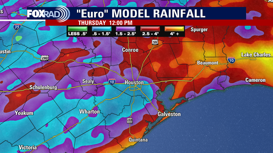
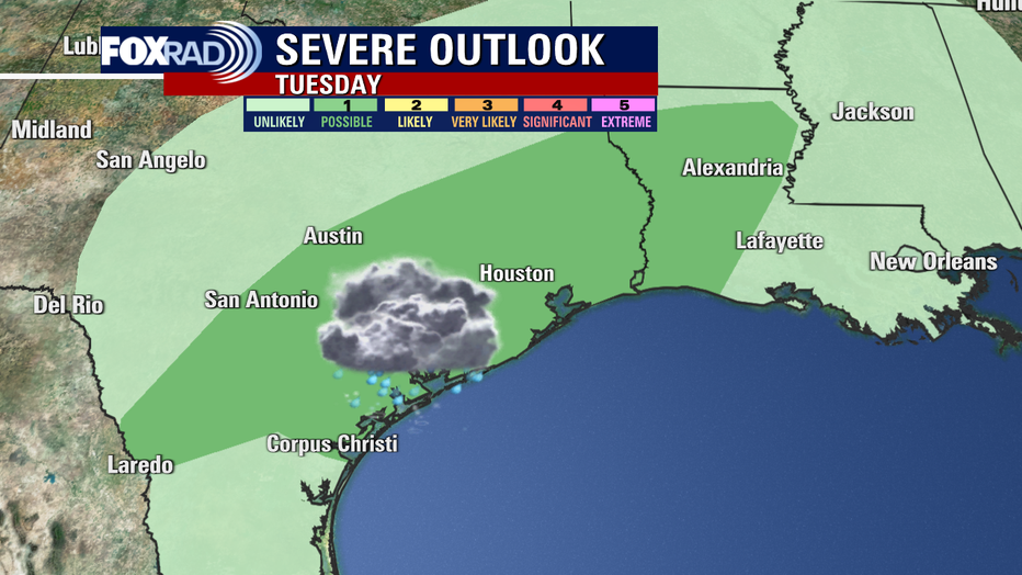
We remain in a slight risk for heavy rain that could lead to street flooding for Tuesday and Wednesday, along with a low threat for a few severe storms.
Main threat would be hail around 1" and some strong wind gusts around 60 mph.
Look for scattered showers Tuesday morning with another big round of rain and strong storms arriving around 4-5 pm Tuesday, just in time for the evening rush.
Models are showing an even bigger round of rain and storms for Wednesday morning through the drive home Wednesday evening.
The silver lining will be the fact that temperatures are much warmer than they were last week when we had wind chills near zero for some!

Remember to download our app for your smart television, FOX Local to get exclusive content and extra coverage of this week's flood and severe storm threat.

At least the weekend is looking much drier and brighter! Make your plans now!