

Houston weather: Severe storms possible Monday
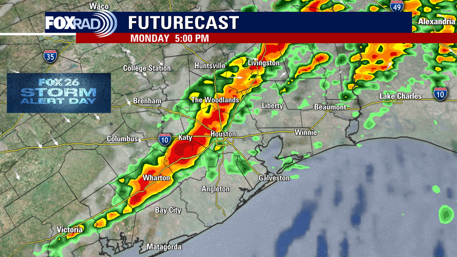
HOUSTON - Monday is a FOX 26 Storm Alert Day. Rain moves into Southeast Texas during the morning with stronger storms and downpours starting after 10 a.m.
Watch for a line of storms to develop later in the afternoon along a cold front. For folks heading to NRG Stadium for the CFP Championship, lightning and strong wind gusts could impact tailgating.
Download the FOX 26 Weather App and keep an eye on the radar.

The afternoon cold front pushes a line of storms that could create damaging winds, hail, and even an isolated tornado.
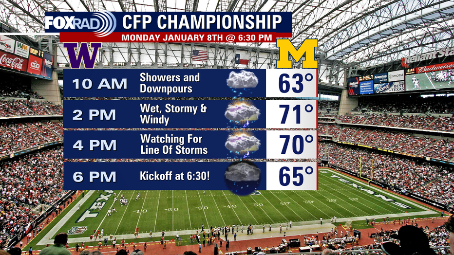
There are lots of visitors in town for the CFP Championship activities and game. Stay safe avoiding the showers and storms. Temperatures will be warm ahead of the front with a high in the 70s, but cooler and windy weather follows the front for the middle of the week.
FOX 26 Houston Weather Forecast
Today is a Fox 26 Storm Alert Day - We are expecting scattered strong to severe storms to develop by late morning and through the afternoon. Some storms could cause gusty winds, hail and there is even the chance for isolated tornadoes. Stay alert with our Fox 26 weather app and download Fox Local to your smart TV. A wind advisory is also in effect for today and tomorrow. After a line of late-day storms today, our weather will turn windy and much cooler by Tuesday morning.
The severe weather threat peaks in the 2 p.m. to 8 p.m. time frame as the front moves into the region and off the coast. There could also be a few storms developing behind the front, but the rain should end around midnight.
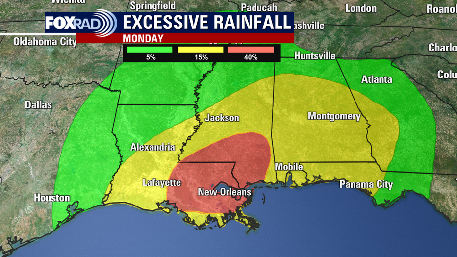
The Weather Prediction Center expects higher chances of flooding for Louisiana and Mississippi, but parts of Texas are included in their Excessive Rainfall Outlook.
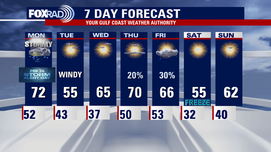
A quick warmup is expected towards the end of the week, but another strong cold front will push temps down around freezing heading into next weekend.