

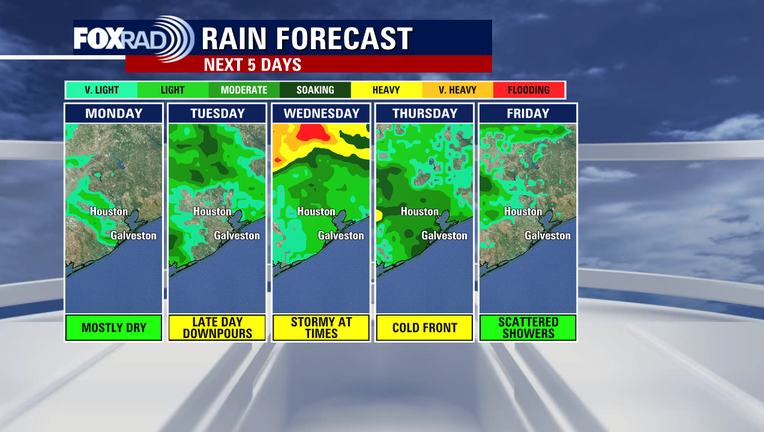
Houston Weather: Look for several rounds of showers, storms this week
HOUSTON - The first storm system will approach the Houston area on Tuesday.
STAY UP TO DATE WITH THE FOX 26 HOUSTON WEATHER APP
Showers and thunderstorms will develop across Southeast Texas during the afternoon and evening hours.
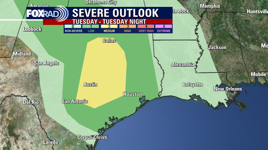
It’s possible some of these storms could be strong or even strengthen to severe.
The main threat will be concentrated in the north and west of downtown Houston. The Storm Prediction Center has given a Slight Risk (level 2/5) of severe storms with the primary threats being damaging wind gusts and hail.
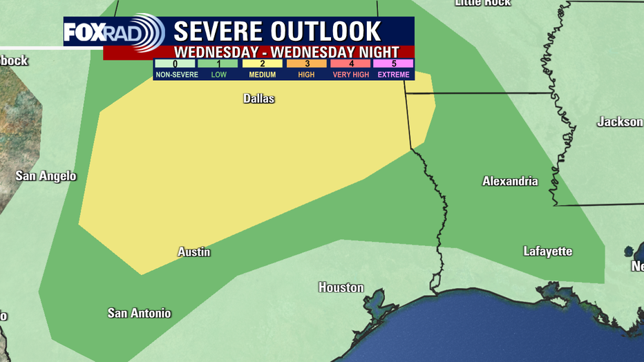
Another round of storms could find their way into Southeast Texas on Wednesday, with showers and thunderstorms developing mainly during the late afternoon and evening hours.
These storms also could be strong to severe, including hail and strong winds.
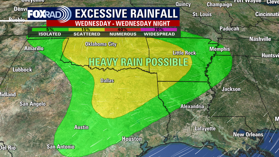
Additionally, on Wednesday, these storms may produce periods of heavy rain. 1 to 2 inches of rainfall are expected to fall area-wide.
CHECK OUT JOHN DAWSON'S HURRICANE GEAR TEST
Soaking rains could hit some spots with higher amounts of rainfall. The heavy rain potential, much like the severe weather potential, will increase further north.
7-day weather forecast with Meteorologist John Dawson
**EDITOR'S NOTE: The forecast above is dated as of Monday afternoon, April 24** We have an interesting and somewhat difficult forecast ahead this week. We'll begin with another unusually cool day with highs about 10 degrees below average. Storms are possible tomorrow, especially west of Houston with a few possibly severe. Warmer, more humid breezes blow in Wednesday along with scattered showers. A late week front should bring more cool air by this weekend.
There will also be a cold front early on Thursday morning bringing another chance for rain. At this time, that round of rain appears to be showers only with a few thunderstorms.